
How Webster Groves Streets Become Records
For a street-by-street question, begin with the address in its USPS form, including direction, suffix, unit, and returned ZIP+4 when available. Put that version into the St. Louis County Assessor IAS search. Save the locator and the displayed tax year before moving on. The card supplies the county's working identity for the parcel, not a promise that a named owner lives at the address. That distinction matters on any Webster Groves street with trusts, estates, businesses, or a separate mailing address.
Once a locator is known, use the City Map Center or county map only to discover the parcel's position, adjacent lots, municipal label, and the next address to check. Each visual result needs its own IAS card. Then move from the current card to the Recorder, where instruments establish a dated ownership trail. For an older address, use a reverse or criss-cross directory by street and house number. This sequence keeps current property administration, recorded title evidence, and historical household references in their proper lanes.
- Standardize the street address and search IAS by Property Address. Record the returned locator, owner line, mailing or taxing address, subdivision, lot or block, and deed reference.
- Open the City Map Center or county GIS to find the parcel and nearby street positions. Treat its display as a discovery aid, then validate every candidate through the address or locator card.
- Use the locator, document number, Recorder book/page, or names from the parcel card to locate a recorded instrument. Log the date and legal description with the names.
- For a past household, browse the applicable reverse directory by street and number. Pair an entry with a deed, permit, tax record, or newspaper reference before drawing a conclusion.
- Keep separate notes for owner, grantor or grantee, applicant, and occupant. These roles can point to different people at the same Webster Groves address.
Note: A current property card and a dated directory entry answer different questions, so preserve the source date beside every name.
Webster Groves Street Directory in IAS
IAS offers four routes that are useful when a street directory search begins with imperfect information: Locator Number, Name, Property Address, and Subdivision Name. Property Address separates street text from direction and suffix, which helps when an older source abbreviates a street type or omits a direction. Name searching can return more than one parcel, so compare the municipality, subdivision, and mailing or taxing fields before assuming a match.
The locator is the strongest bridge from a street address to a parcel card. It uses two digits, an alphabetic third character, and one to six later digits, with no spaces. The portal requires at least four characters and permits up to nine. The alphabetic third character is a useful local quirk: an all-numeric number that looks plausible will not satisfy the locator rule. The result remains current assessment and tax information. Recorded instruments belong with the Recorder.
| IAS mode | Field or control | Input | Format or use |
|---|---|---|---|
| All modes | Search By | Selector | Choose Locator Number, Name, Property Address, or Subdivision Name. |
| Locator | Locator Number | Required text | Two digits, letter in third position, then 1 to 6 digits; no spaces. |
| Name | First Name and Last Name | Text | Compare returned parcels with address and mailing or taxing information. |
| Address | Street, Direction, Suffix | Text and dropdowns | Use the full standardized address and try documented spelling variants. |
| Subdivision | Subdivision Name | Text | Useful when a legal or directory reference names the subdivision. |
| Results | Display case | Radio choices | Proper Case, Upper Case, or Lower Case may change display only. |
The IAS card can show a locator, tax year, owner, taxing address, subdivision, short legal description, lot and block, land-use code, and deed document/type/book/page. It can also show school and council district fields. Its short legal description is an administrative aid, not the controlling legal instrument. A paper deed or plat may give the fuller description needed to connect an older lot to a modern parcel.
Map a Webster Groves Street Carefully
The Webster Groves Map Center links city map material and county data resources that help place a street within the municipality or a historic district. The county GIS can help a searcher discover parcel shape and adjoining addresses. Neither screen is a legal survey. The city warns that GIS information is supplied as-is and is not 100 percent accurate, so an apparent boundary, lot line, or frontage answer needs confirmation through IAS and, when necessary, a Recorder instrument or survey.
Map discovery is especially useful where postal names, city limits, or historic district labels compete. A Webster Groves mailing address can require a municipality check, and a historic district is a geographic clue rather than a title boundary. Save the map date and layer context in the research log. Then verify each displayed parcel separately, rather than assigning the visible name from one card to several addresses.
See the Webster Groves Map Center for the city entry point to its map resources.
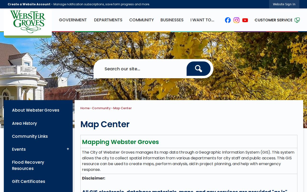
The Map Center is a useful starting screen for a Webster Groves by-address search, but the parcel card and recorded land documents remain the sources to verify.
Webster Groves Street Records by Address
A single address can lead to several records, but they do not identify the same relationship. The following coverage is keyed by a property, street, or household reference and gives a practical order for a Webster Groves street directory search. Start with the current parcel, then use the dated layers that fit the time period. Do not convert a taxing address, a permit contact, or a directory line into a present-tense occupancy claim.
| Address-keyed evidence | Custodian | Period or route | What it can show |
|---|---|---|---|
| IAS parcel card | St. Louis County Assessor | Current assessment and tax display | Locator, owner line, subdivision, parcel facts, and deed reference. |
| Map resources | City Map Center and county GIS | Current map display | Parcel position and nearby geography, subject to IAS confirmation. |
| Recorded instruments | St. Louis County Recorder of Deeds | Index, counter, copy form, or mail route | Grantor, grantee, date, document or book/page, type, and legal description. |
| Tax microfilm | Webster Groves Public Library | 1896 to 1947 | An owner or parcel connection before the modern web card. |
| Building permit material | Webster Groves Public Library and city custodians | Microfilm 1908 to 1996; searchable index through 1940 | Project address, work, and named project roles, not proof of occupancy. |
| Reverse directories | WGPL and St. Louis County Library resources | Directory volumes and year-specific browsing | Street, house number, and a historical household reference. |
For a local records request, the city form or the right department can supply a fallback when an online display stops short. Narrow the request to the project address, record type, and date range. Missouri Sunshine Law procedures apply to open records, but closed material and personal details may be redacted or withheld.
Webster Groves Street Records at the Recorder
The St. Louis County Recorder of Deeds maintains the recorded documents that turn an assessment clue into a conveyance trail. A result can show the grantor and grantee, recording date, document number, affected book/page or book/page, page total, locator or lien number, instrument type, and legal description. Search by the deed number or Recorder book/page from IAS when possible. If a locator does not return a document, try the names and book/page instead because a locator is not guaranteed in every instrument.
Recorded results are not a claim of universal online image coverage. The research did not locate a complete public statement of the online index or image range, nor a universal price schedule for remote searching. The practical alternatives are the official deed-search route, the Recorder counter, and the deed-copy order form by mail. That form accepts an address, owner, approximate purchase date, document type, document number, or Recorder book/page. It distinguishes Recorder book/page from assessor book/page, a difference worth checking before ordering a copy.
A warranty deed may document a transfer. A deed of trust records a financing relationship, and a release can close one without showing a sale. Capture instrument type and the legal description alongside the names so the next search follows the same parcel rather than a similar street address. For a title-grade answer, use the Recorder's certified-copy process and appropriate professional advice.
Note: An index row is a finding aid, while the recorded image or certified copy carries the fuller document content.
Permits Along Webster Groves Streets
Permit and planning files add a dated project layer to an address. The city building application asks for project address, permit number, description, cost, owner and contact roles, contractor or design professional, and review checks such as historic, ARB, TPP, or zoning status. A listed applicant might be an owner, contractor, or designer. Label the role as shown and do not treat a permit contact as a household member.
For older work, the Webster Groves Public Library homes resource identifies building permits digitized from microfilm for 1908 through 1996, with a searchable index currently updated through 1940. The same resource identifies real-estate tax microfilm from 1896 through 1947. The city archive can add address or street references in ARB, Historic Preservation Commission, Plan Commission, Board of Adjustment, public-hearing, and council material. Search the modern spelling, older spelling, owner surname, subdivision, and project type.
The 2025/26 city bid to preserve property-maintenance, permit, inspection, and planning files points to possible future access improvements. It is an initiative, not evidence that every street file is digitized or public now. For newer eligible occupancy and MEP work, the city also documents an online permit workflow, while some plan-review and other cases use a different process.
Reverse Listings for Webster Groves Streets
A criss-cross directory, also called a reverse directory, organizes entries by street and house number rather than by surname. That makes it the historical household layer for a street directory search. The address must still be interpreted with its publication year, municipality label, and page image. A reverse entry can associate a person with an address at that time; it does not establish a current residence or prove that every person in a household was listed.
WGPL links Hodgdon's Webster Groves directories for 1907 and 1908 to 1909. St. Louis County Library's county-directory resources have a stated run of about 1893 to 1979, with print, microfilm, microfiche, and digital access layers. Select a year, search a surname or partial address, then browse the volume. OCR can miss street numbers, initials, and abbreviations, so inspect nearby pages and the street section when a search produces no result. The deeper directory collections are described on the Webster Groves City Directory page.
Webster Groves Street Directory Terms
Street research becomes more reliable when the address vocabulary is kept straight. The words below refer to different parts of a land or directory record, and each can be the key that bridges a changed address to an older reference.
- Parcel
- A county-recognized piece of real property identified in IAS by a locator and related parcel facts.
- Situs address
- The physical location of the property. It can differ from an owner's mailing or taxing address.
- Plat
- A recorded map that lays out lots, blocks, streets, easements, or a subdivision. It can explain a changed lot description.
- Criss-cross directory
- A reverse directory that begins with street and house number, then identifies a historical occupant or household reference.
Compare the exact source spelling with the current USPS form instead of forcing an old abbreviation into a modern search field. Street strings can drift, and an old record can use Webster, a county label, or a different suffix. The 1876 separation of St. Louis City and County and the 1896 incorporation of Webster Groves are useful breakpoints when the expected municipal record is not found.
Webster Groves Street Directory Across Time
Current county data and older paper or microfilm collections are not competing versions of the same directory. IAS is built for current assessment and tax administration. A 1909 plat, a tax microfilm reel, a permit card, or a reverse listing answers a historical question that the current card cannot answer. Treating each source as dated evidence makes contradictions easier to explain instead of hiding them.
For example, a recorder date may lag a move, a directory may have been compiled before publication, and a permit may name a contractor instead of the person associated with the address. Put deed recording date, directory year, and permit or inspection date in separate columns. A mismatch may reflect how the record was created, not an error that should be silently corrected.
Limits of a Webster Groves Street Directory
No official citywide resident list was identified for Webster Groves. A parcel owner, a name on a deed, a taxing address, a project applicant, and an entry in a historical directory are different claims. The city and county systems also protect some information. Do not infer a current occupant from an old directory, a current owner from a permit contact, or an address from a protected voter or Safe at Home record.
Lawful personal use. Use Webster Groves address records for personal, historical, family, estate, or civic research. Do not republish protected addresses or private contact details, and never use a record to stalk, harass, threaten, or harm another person.
When records disagree or a document is unavailable, report the result as an index entry, an image inspected, a secondary reference, or an unverified lead. Confirm material facts with the office that keeps the record. That careful wording is more useful than a confident claim built from one address search.